
Posted on May 13, 2019
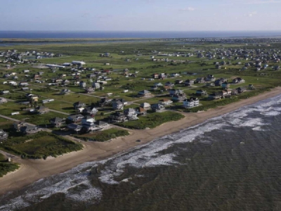
HOUSTON/GALVESTON – Sand dunes, not 70 miles of levees and gates, would flank flood gates at the mouth of Galveston Bay under a new plan the U.S. Army Corps of Engineers is studying to protect the Houston-Galveston region from storm surge.
The proposal is the latest version of the Coastal Spine, a $31 billion barrier the Corps selected last year — a decade after Hurricane Ike, the cyclone that spurred the discussion — as its preferred method for mitigating the catastrophic fallout of a strong storm hitting Galveston Bay.
The Corps’ shift is a response to concerns from residents on Bolivar peninsula and Galveston Island, who found the agency’s original proposal to build levees on the barrier islands disruptive.
“Once we started getting those comments, it became very clear,” Corps Project Manager Kelly Burks-Copes said, noting that dunes were always an option. “We dropped that barrier solution and formulated a new solution, which is a dune-and-beach system along the front of Bolivar and along the front of Galveston below the seawall.”
That was welcome news to Bolivar resident Margaret Lindlow.
“I didn’t really care for that barrier wall running down the middle of the peninsula,” she said. “I know something has to be done, and if we have to put some kind of barrier there, then I think it should be at the beach.”
The proposal — which has not yet shifted the project’s cost or its 2035-at-the-earliest completion date — would have the Corps bolster the existing dunes by plugging beach access roads to create a continuous barrier, and, in some cases, restoring access with arched walkways or roadways over top of the added sand.
The agency also has scrapped a single 25-foot-high gate at the mouth of Galveston Bay for two smaller gates, Burks-Copes said. That approach would be cheaper and allow shiptraffic to continue if one gate malfunctioned. Experts from England, the Netherlands, Russia and elsewhere are helping redesign the gates to lessen the constriction of water flow at the mouth of the bay, she added, a key concern of environmental groups worried about the effect on marine life.
“What they’ve done on the beach makes sense, it’s a good way to think about things,” said Bob Stokes of the Galveston Bay Foundation, adding that the initial gate design would have restricted water flow by 27 percent. “I hope they’re looking for improvements on the flood gates, too — and they’ve told us they are.”
Swapping 17- to 20-foot inland levees for 8- to 13-foot-high coastal dunes increases the risk that a storm could overtop them, Corps officials said, but they added that dozens of computer-generated hurricane models of varying paths and intensities must be virtually slammed into the shore before that risk can be quantified. If calculations suggest the proposal provides too little protection, Burks-Copes said, projections could be run again using larger dunes.
Models show flood gates alone would repel 60% of the water associated with a storm surge, Burks-Copes said. In addition, Corps planning chief Brian Harper said the currentdune proposal would drop the water level even at the northern end of the bay by a projected two feet during a storm.
“We’re acknowledging that with the dune systems we’ll probably have to tolerate a little bit more remaining risk than we would have had with the levee segments we’d originally suggested but, perhaps, tolerating that additional risk is worth avoiding the impacts we were seeing with those segments,” Harper said. “We believe it’s tolerable, because we have the volume of the bay to work with to help us manage some of that surge that would potentially overflow the dunes.”
Drawing on dunes to bolster the region’s defenses mirrors what Texas A&M Galveston scientist Bill Merrell proposed in his “Ike Dike” idea shortly after that storm. Merrell said his models showed 17-foot dunes provided robust protection, though he said the Corps may be measuring its 13-foot estimate from the beach rather than from sea level, as he did.
“Even if they’re over-topped they provide quite a bit of protection. Our models have always shown that,” Merrell said. “The really big (storms), it’s prohibitively expensive to protect against anyhow. I think they’re looking at the right sorts of issues now and trying to design a better barrier.”
Jim Blackburn, an environmental attorney and co-director of Rice University’s Severe Storm Prediction, Education and Evacuation from Disasters (SSPEED) Center, also praised the Corps for embracing dunes as a defense.
In a paper he authored this week, Blackburn said his models show the original 17-foot levees would not have prevented flooding in the Houston Ship Channel, Bayport Industrial District and residential areas on the western shore of the bay if that area were hit by a Category 3 storm and an accompanying 25-foot storm surge, risking the release of toxins from ruptured petrochemical tanks.
Blackburn’s report said his and his Rice colleagues’ Galveston Bay Park Plan would protect those areas in such a storm, as it would provide a 25-foot-high wall across the middle of the bay. The idea was not selected by the Corps for further study.
Corps officials said blocking the surge at the coast would help the entire region, including the ship channel, but acknowledged that a hurricane entering the bay still could produce a storm surge of up to five feet from its winds alone, causing flooding on the western shore.
“We do understand that there is residual risk in the bay and up the ship channel with the system we’re recommending,” Harper said. “The park plan was developed with a worst possible storm in mind, and that storm could happen. There is enough volume in the bay to create those water surface elevations.”
Burks-Copes said the Corps views Blackburn’s idea as complementary to its plan.
Blackburn has urged supporters to attend a May 15 meeting Harris County Commissioner Adrian Garcia has called on the topic of storm surge, stressing a point noted in his report this week: the material produced when the Port of Houston dredges the ship channel — as it hopes to do within a few years — could produce a historic “piggyback” opportunity to use the dredged material in the construction of a mid-bay berm.
See San Antonio Express News article . . .
Listen to ASPN interview of Kelly Burks-Copes, USACE
Listen to ASPN Interview with Jim Blackburn, SSPEED Center
Source: coastalnewstoday.com


