
Posted on September 26, 2017
By Mary McKenzie, Wicked Local
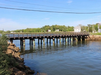
As the community gears up for fall Town Meeting and a new 10-year Master Plan, the topic of dredging – or removing layers of sand and silt that have built up in navigational channels and make it difficult for boats to get through – has come up several times.
Wareham’s Planning Department, Department of Natural Resources (the Harbormaster’s office), Marine Resources Commission and the many people who enjoy boating around the town’s extensive coastline, would all like to see dredging projects, particularly in the Wareham River, be taken on by the U.S. Army Corps of Engineers to get rid of buildup that Selectman Alan Slavin referred to as “black mayonnaise.”
At a meeting with the Marine Resources Commission last month, Harbormaster Garry Buckminster summed up the issue on the Wareham River. “There are some obvious changes to the water depths,” he said. “There are ways to circumvent the problem there if you play the tides right, but it is definitely not at the levels it is supposed to be.”
Why do navigational channels – which are channels that were dug by the federal government to create easy passage in and out of harbors for commerce – require dredging?
“As sand and silt washes downstream, sedimentation gradually fills channels and harbors,” according to the National Ocean Service, which is part of the Department of Commerce. “This material must be periodically removed by dredging.”
THE ISSUE: Wareham’s waterways need expensive dredging to help remain viable for recreational use.
THE IMPACT: A lack of dredging could impede waterway navigability and hurt recreation and tourism in Wareham.
One of the reasons the federal government maintains the channels is the same reason it dug them – massive ships carry in and out much of our nation’s goods. So shipping plays a crucial role in the economy.
But in a town like Wareham, where the population doubles from 22,000 to about 45,000 every summer, much of the fishing and boating is for fun, which Harbormaster Buckminster said may negatively impact the priority of spots like Wareham Harbor for the federal government. “We have a lot of recreational fishing here, we are not New Bedford,” he said.
According to the Army Corps of Engineers, the Wareham Harbor area was first dug in 1876 as a two-mile-long, 10-foot-deep, 250-300-foot-wide channel in the lower harbor and a nine-foot-deep, 100-foot-to-300-foot-wide channel in the upper harbor, narrowing to 100 feet wide along the Wareham waterfront, “immediately below the U.S. Route 6 Bridge.”
“In 1896, the Corps completed a nine-foot channel extending 1.8 miles from the harbor entrance adjacent to Long Beach to the lower wharves at Wareham,” said Timothy Dugan, spokesman for the Army Corps of Engineers-New England District. “From the harbor entrance to Barney’s Point, a distance of one mile, the channel is about 125 feet wide. From Barney’s Point to the lower wharves at Wareham, the channel is about 250 feet wide, narrowing to 100 feet for its last 1,500 feet up to the U.S. Route 6 Bridge.”
Dugan said that Massachusetts deepened the channel in 1917 to 12 feet from 0.4 miles from the harbor entrance at Long Beach to just above Barney’s Point.
In addition to the Wareham River, residents have brought up at various town meetings that Buttermilk Bay, Onset Bay and Sunset Cove need dredging. ACE New England lists Wareham Harbor, Onset Bay and Buttermilk Bay as dredging projects in its purview on its website: www.nae.usace.army.
“We do have a number of locations that have been mentioned in town,” said Planning Director Ken Buckland. “But we want to be smart about what we ask for. It’s not an open checkbook and you want to pick places that give the most ‘bang for the buck,’ so to speak, when you are talking about tax dollars.”
The Planning Department has been tapped by the Department of Natural Resources to provide information to the Army Corps of Engineers for an application. “Our end will focus on local need for dredging, demographic information, the community’s economy and the importance of the waterways to the economy,” said Buckland.
With the planning, equipment, permitting, and oversight needed for a dredging project, it is always an expensive undertaking.
Rene Kolman, secretary general of the Netherlands-based International Association of Dredging Companies (IADC), called it “capital intensive. Mobilizations/demobilization of equipment is a cost you have to face, regardless of the size of the project.”
The price tag goes up considerably if the material dredged up is deemed contaminated.
“If you have to deal with a contaminated site, costs will be much higher than a regular site” said IADC’s Kolman. “It depends fully on the characteristics of the dredged material, if it can be reused for specific purposes.”
The price tag is not lost on local leaders.
“The problem with dredging projects is it is millions of dollars, and if it is not on the federal government’s bill, it is on the shoulders of taxpayers in the community that needs it,” said Larry Bearse, a Master Mariner and member of the Marine Resource Commission who served as Master of the U.S. Oceanus, a research vessel, for 28 years at Woods Hole Oceanographic Institute.
And communities throughout Eastern Massachusetts have applied for dredging projects to the Army Corps of Engineers New England office, which oversees some 170 federal navigation projects in the region. Marshfield, Quincy, Wayland and Plymouth are among recent applicants for dredging projects listed on the ACE New England site this year.
There are voices here that want to see Wareham on that list of applicants for dredging and the town’s Marine Resource Commission is one of those voices.
“The prospect of defeat should not preclude a concerted effort in trying,” said longtime Wareham resident Bearse, noting the competition has surged among dredging projects before the Army Corps of Engineers along the Massachusetts coast. “The rivers and waterways are Wareham’s greatest asset. They are in dire need of home town support immediately and continually.”
Bearse said he wants to see the federal government maintain the channel it dug, “to allow safe travel for private and commercial vessels, to flush the waterway for shellfisheries and aquaculture, and to provide improved access to town docks, allowing for quick emergency transport to Tobey Hospital as well as downtown businesses.”
“The Wareham River is and has been silting and filling in over many years,” he said. “Of particular interest is the navigation channel. The responsibility for this is on the federal government – via the U.S. Army Corps of Engineers, and not the town of Wareham.”
Because the Wareham Harbor was designated by the federal government as a navigational channel, ACE New England spokesman Dugan said, it is the location that would be eligible to receive federal grant money for dredging.
“This location was designated by Congress,” Dugan said. “The only areas we would consider are those designated by the federal government.”
So what are the options for other locations?
Dugan said that for the other projects mentioned in town meetings “that responsibility would be up to the town or the folks who want to get it done.”
The Army Corps of Engineers would need to approve the project, but that means funding would be done by a private entity.
Although locations other than the Wareham River might not be paid for by the federal government, dredging at multiple locations may reduce the cost of work being done at each site as the equipment will already be in use.
“As it is a capital intensive industry, mobilization/demobilization of equipment is a cost you have to face, regardless the size of the project,” said the IADC’s Kolman. “Multiple sites can give a lower price per, as mobilization/demobilization has to be done only once.”
Disposal of dredged material is managed and carried out by federal, state, and local governments, as well as by private entities such as port authorities. The U.S. Army Corps of Engineers issues permits for the disposal of dredged material. The U.S. Environmental Protection Agency provides oversight and authorization for the disposal of dredged materials.
“That is always part of the project at the Army Corps of Engineers,” said ACE spokesman Dugan. “It’s one of the first things we look at.”
And costs go up if the material dug up is deemed contaminated.
“If you have to deal with a contaminated site costs will be much higher than a regular site (e.g. the Fox River),” said IADC’s Kolman. “It depends fully on the characteristics of the dredged material, if it can be reused for specific purposes.”
Source: Wicked Local


