Posted on January 22, 2019
The U.S. Army Corps of Engineers, St. Paul District, just announced it is going to use dredged material to improve habitat on the north end of Lake Pepin by building new islands.
It’s a partnership involving the Lake Pepin Legacy Alliance and the Wisconsin DNR.
Lake Pepin is the largest lake on the entire Mississippi River. But the big lake is filling up with sand, especially the north end. And it’s impacting wildlife, boating and a trillion-dollar-a-year shipping industry.
So, how much sand flow goes into the lake?
“It’s about a million metric tons,” said Rylee Main, Executive Director of the Lake Pepin Legacy Alliance. “And to visualize that, it’s a full city block raised to the height of the Foshay Tower in downtown Minneapolis. That accumulates primarily at the head of the lake every single year.”
It’s really bad in Bay City, Wisconsin. You can get a boat into the water, but not out of the harbor because it’s too shallow.
The entire area is part of Pool 4 on the Mississippi River. The Islands Project is one of 10 projects selected out of 95 proposals submitted throughout the United States. Corps.’ engineers plan to develop islands in the Mississippi River at the Head of Lake Pepin to restore backwater habitat.
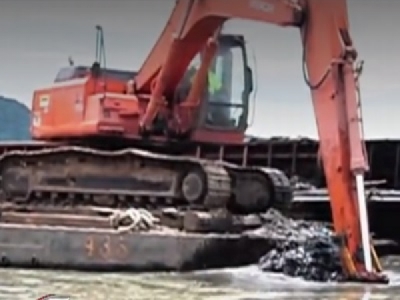
The Corps. will beneficially use dredged material removed from Reads Landing Dredged Material Placement Site in Lower Pool 4, located just north of Wabasha, to construct the islands. The island construction project could use up to 500,000 cubic yards of dredged material that’s already been removed from the Mississippi River at the confluence of the Mississippi and Chippewa rivers.
“The overall project will likely cost between 10 and 20 million dollars,” said Angela Dean, the Lead Project Planner. “It’s a really exciting opportunity for Lake Pepin. It will provide a restoration opportunity for habitat that’s degraded in the area.”
Dean explains why the Corp. of Engineers is building islands.
“We strategically place islands in the Mississippi River in order to block wind and wave action coming from the bigger lake, as well as create calmer, backwater areas for improving water quality and habitat for our wildlife.”
The Islands Project is also a solution to a big problem on the south end of the lake. The Corps. of Engineers has run out of places to put massive amounts of sand dredged from the Mississippi River to keep the navigation channel open. The sand comes from the Chippewa River in Wisconsin. It enters the Mississippi River near Reads Landing, Minnesota on the south end of Lake Pepin.
“The Chippewa River is geologically speaking a very young river,” said Robert Edstrom, Project Manager in charge of dredging the river in Lower Pool 4. “It’s dumping a lot of sand into the Mississippi River, which is an old River. And that created a natural backup that forms Lake Pepin.”
That sand is perfect for building islands. The plan is to fill barges up and move the sand from Reads Landing, almost 20 miles to the north end of Lake Pepin and create islands.
“Building islands in Upper Lake Pepin will be a great success story for the Corps. and its partners,” said Tom Novak, project manager. “Not only will we improve the environment with this project, [but] we will also create some additional storage capacity for the dredging requirements near Wabasha.”
Corps. engineers said the next step in the island construction project is to compare the costs and benefits of alternatives and put forward a selected plan for agency and public review. The final plan will be completed by spring. Construction could begin as soon as 2020. The project will be 100 percent federally funded.
Corps. engineers also added the island construction project will provide up to three years of additional dredged material storage capacity but will not solve the dredged material placement needs near Wabasha since the Corps. removes approximately 250,000 cubic yards of dredged material annually from Lower Pool 4.
The Lake Pepin Legacy Alliance and its supporters are helping with habitat restoration on the north end of Lake Pepin. Main says they’ve been recommended for $750,000 from the Lessard-Sams Outdoor Heritage Council. She said they’ve also raised $125,000 from local municipalities and pledges.
“Our long term goal is we want all the communities around Lake Pepin to have access to the lake,” said Main. “We were the only project on the Mississippi River of 22 projects that applied for this funding. The islands themselves will be seeded with native plant species so you can improve flood plain forest. The hope then is we’ll see a lot more swans coming through the area and other migratory birds as well.”
The U.S. Army Corps. of Engineers also has plans to create seven islands in Pigs Eye Lake, just east of St. Paul in upper Pool 2 of the Mississippi River in Ramsey County.
The estimated cost of the project is $12,600,000.
In connection with channel maintenance dredging on the Mississippi River, the Corps. of Engineers has stockpiled sand at various sites along the river for use by the public. Material stockpiled at federally owned sites is available free of charge and is being used for a variety of purposes.
Source: kstp


