Posted on July 15, 2020
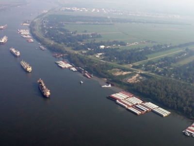
NEW ORLEANS, La. (WVUE) – The Mississippi River Port system is one of the largest and most influential in the world and it’s about to get a little smarter. A new collaboration announced Monday, July 13 plans to make operations safer and more efficient across Louisiana’s shipping industry.
The Mississippi River is in many ways the life’s blood of Louisiana’s economy. Louisiana Economic Development Secretary Don Pierson said, “You know Louisiana as an energy state. You know Louisiana as an agriculture state; a state of advanced manufacturing; a state of forestry but the common denominator here is around our highways, our rails and our more than 30 ports.”
Governor Jon Bel Edwards and officials from the state, Port of New Orleans and the non-profit Water Institute of the Gulf signed a cooperative agreement that will use technology in the hopes of making that transportation system work even better.
Pierson said, “Science will allow us to drive and protect commerce on the river and in doing so we build a more prepared and more resilient Louisiana.”
Sensors will be installed on tugboats and other vessels in the New Orleans Port District that measure sediment levels in real-time.
Brandy Christian, Port of New Orleans President and CEO, said, “Access to accurate and timely data and ultimately the ability to predict the river will allow us to dredge appropriately and efficiently.” The information will help reduce expenses and delays in getting ships to port by allowing more targeted dredging before traffic needs to be restricted.
The second phase will digitally connect all stages of shipping including the ports, their tenants, rail and trucking companies.
Future plans call for similar technology to support a hurricane and flood risk center for the state located at the Water Institute campus in Baton Rouge where the announcement took place.
Governor Edwards said, “The Water Institute is going to help us monitor coastal data to determine more precisely and hopefully as far in advance as possible the level of response we’re going to need to assemble in response to any particular storm or emergency.”
The first phase of sensor installations will take two months. Pierson said, “Once we get the software in place and communication in place (it) can be expanded along the Mississippi River on its journey through Louisiana.”
The cooperative expects to deploy the system through the state’s other waterways.
“The data we collect and analyze through these efforts are going to make our ports smarter and more efficient, but also they are going to make our people safer,” according to Governor Edwards.
Keeping major shipping arteries moving smoothly and teaching us about sediment movement along our ever-changing coastline.
Source: kalb


