
Posted on December 4, 2018
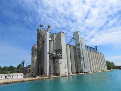
Over the past 170 years, the 42-mile St. Clair River has seen its forests clear-cut, wetlands drained, banks urbanized, beaches and landings seawalled and its nearshore spawning grounds dredged and polluted.
By 1987, the river had become a resource increasingly hostile to the species that depended upon it — fish, birds, wildlife and humans.
In 1987, 12 of a total of 14 beneficial uses of the St. Clair River were designated as impaired on the Canadian side when the river became one of 43 officially designated environmental hotspots in the Great Lakes — known as Areas of Concern — under the Great Lake Water Quality Agreement between Canada and the United States. Ten beneficial uses were impaired on the U.S. side.
The St. Clair River Area of Concern was one of the five binational Areas of Concern.
This degradation is now slowly being reversed.
Three previously identified impairments to the river in Canada have been sufficiently cleaned up to be deemed “not impaired” by the Canadian government.
The impairments were restrictions on dredging activities, beach closings and bird and animal deformities and reproduction problems.
“Redesignating these as ‘not impaired’ means we’re moving closer toward delisting the river as an area of concern,” said Kelly Johnson, remedial action plan coordinator for the St. Clair Region Conservation Authority in Strathroy, Ontario, Canada.
The Canadian Remedial Action Plan Implementation Committee announced the accomplishments Nov. 23.
“Comprehensive surveys and monitoring confirm restoration targets have been successfully achieved,” the CRIC said in a release. “The ‘not impaired’ designation of these beneficial use impairments represents significant progress towards the restoration of the St. Clair River.”
Restrictions on dredging
By 1987, the navigational channel of the river and Sarnia Bay, which was owned by the Canadian government and serviced freighters, was so polluted that any material dredged from them could not be dumped in open water.
The main culprits were heavy metals, polychlorinated biphenyls, oil and grease, much of which was potentially carcinogenic. Dredged material had to be hauled inland to designated facilities, which added money to the cost of dredging, often critical to navigation.
Today, even clean dredging spoils may not be dumped in open water because of the danger it poses to fish and their habitats.
Over the past two decades, most dredge spoils have been clean enough for reuse.
“Both the federal and provincial governments provide comprehensive control and oversight around the dredging and the disposal of dredged material,” the CRIC said. “The procedures for navigational dredging and disposal of dredged material within the St. Clair River Area of Concern are consistent with those that occur throughout the Great Lakes.”
Beach closings
By the mid-1980s, beaches along the Canadian side of the St. Clair River were frequently closed to the public due to high levels of bacteria, including E. coli. The three main sources of bacteria were combined sewer overflows, effluent from the Water Pollution Control Plant, Sarnia’s wastewater treatment plant and agricultural runoff.
The Canadian communities in the area of concern have largely separated their storm and sanitary sewer, as well as contributed to the upgrade of the WPCP. Sarnia has spent $35 million on the WPCP since 2012 and $60 million in sewer separation projects.
Local health departments monitored the beaches at Canatara Park; Roger’s Dock, Ferry Beach and Smith’s Beach on Walpole Island, and Mitchell’s Bay. Ten additional locations were monitored from 2011 to 2013.
“In addition, best management practices have been implemented in rural communities, including 37 riparian buffer projects that have mitigated the input of bacterial pollution from the surrounding areas,” the CRIC said. “These combined efforts have dramatically reduced bacteria levels and improved overall water quality of the river.”
Bird and animal deformities
When the St. Clair River Area of Concern was designated in 1987, “Bird or Animal Deformities or Reproduction Problems” were tabbed as “Requiring Further Assessment.”
“The redesignation of this (beneficial use impairment) to ‘not impaired’ status is the culmination of several exposure and field studies conducted between 2006 and 2014 by Environment and Climate Change Canada,” the CRIC said. “These studies assessed the prevalence of deformities and reproductive success in two aquatic indicator species, the northern leopard frog and the common snapping turtle. Based on the studies conducted and the results they revealed, there was sufficient evidence for the designation of ‘not impaired’ status.”
Overall progress
Canada has been able to redesignate six of the 12 impairments on its side of the river.
On the U.S. side of the river, eight of the 10 beneficial use impairments have been removed since 2009, largely because of remediation work paid for by the Great Lakes Restoration Initiative.
The restriction on dredging activities because of contaminated sediments in the river was removed in 2009, added costs of a polluted river to industry and agriculture was removed in 2011, the tainting of fish and wildlife flavor and the degradation of the natural appearance of the river were both removed in 2012, the degradation of benthos was removed in 2014, the closing of swimming beaches on the river was removed in 2016 and the loss of habitat was resolved in 2017.
The two remaining impairments on the U.S. side of the river are restrictions on fish and wildlife consumption and restrictions on drinking water consumption or taste and odor problems.
Source: The Voice


