Posted on January 24, 2019
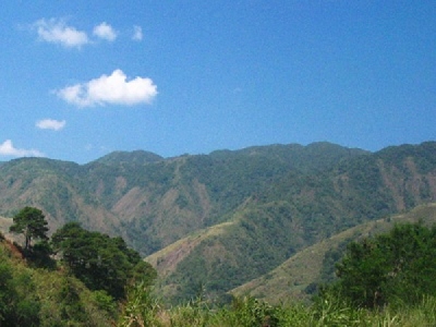
In a move to address Cagayan River basin’s continued siltation, the provincial government of Cagayan has urged the public to take responsibility in bringing back the forest cover along Sierra Madre and the Cordillera mountain ranges.
Cagayan Gov. Manuel Mamba said that the heavily silted Cagayan River bed had also caused the recent flooding, particularly in low-lying areas because the river could no longer contain the excess water from the mountains every time there was a heavy downpour or typhoon.
“We need to dredge the Cagayan River because it is already heavily silted. This way, we can address the problem of floodings in Cagayan Valley (Region2) which affect greatly the lives, properties and economic activities of the people,” Mamba said.
The Cagayan Valley comprises the island province of Batanes, Cagayan and Isabela, and the headwaters of the Cagayan River that are in the provinces of Nueva Vizcaya and Quirino.
Recently, the provincial government of Cagayan created a task force in collaboration with the Cagayan Valley offices of the Department of Agriculture and the Department of Environment and Natural Resources (DENR) to take an action plan in protecting the environment and agricultural lands in the region.
“The task force will craft plans and programs on the protection, preservation and conservation of the Cagayan’s forest cover in coordination with other concerned government agencies in the Cordillera region,” Mamba added.
He said farmers and other sectors should to lessen or avoid the use of pesticides in their farms that cause the loosening of soil, particularly those along the riverbanks and in the upland areas.
Mamba added that huge areas in the region’s forest cover had been converted to agricultural areas.
“We have noticed that more and more farmers have been converting forests into cornfields and vegetable areas. These practices have adverse impacts on the local environment, including land degradation, soil erosion, and increased flooding,” he said.
Mamba said they were also expecting the neighboring provinces of the Cordillera region for the reforestation of the mountain ranges.
The Cagayan River is the longest and largest river in the Philippines. It is located in the Cagayan Valley Region in northeastern part of Luzon Island and traverses the provinces of Nueva Vizcaya, Quirino, Isabela and Cagayan.
The river’s headwaters are at the Caraballo Mountains of Central Luzon at an elevation of approximately 1,524 meters. The river flows north for some 505 kilometers to its mouth at the Babuyan Channel near the town of Aparri in Cagayan Province.
The river drops rapidly to 91 meters above sea level some 227 kilometers from the river mouth. Its principal tributaries are the Chico, Siffu, Mallig, Magat and Ilagan rivers.
According to the DENR-Mines and Geosciences Bureau (MGB) in the region, portions of the Cagayan river in the towns of Amulung, Alcala, Gattaran, Lallo and Camalaniugan, among others, are the most heavily silted.
Engineer Mario Ancheta, DENR-MGB Cagayan Valley director, said a geo-hazard mapping and study was conducted by the bureau that recommended the dredging of the “heavily silted” Cagayan River “to avoid further erosions.”
He said the river’s siltation had been preventing the flow of water when there are flashfloods.
“There are islet formations in the middle of the river which usually alter the direction of the flow of water, thereby, causing continuous erosions along the Cagayan River banks,” Ancheta explained.
In the study, the MGB also recommended some measures to avoid any disorder during calamities, and advised communities and local officials to relocate to safer grounds or establish a resilient evacuation centers during calamities.
The University of the Philippines has also conducted a bathymetric study in the lower Cagayan River and recommended to the provincial government the need to dredge the silted parts of the river.
Fernando Siringan, a marine geologist from the university, said they discovered constriction of channel from a sand bar growth that causes severe flooding during the rainy seasons.
“Dredging will lessen flooding problem and reduce river bank erosion. The geomorphic study of the Cagayan River also helps evaluate potential sites for the establishment of a port in the mouth of the river,” he explained.
Siringan said a large area of the lower part of the Cagayan River was prone to rapid geomorphic changes “which was why dredging is very necessary to remove siltation and to eventually help solve flooding in some parts of the province.”
But dredging cannot be a long-term solution on the flooding problem and there is a need for local officials to associate some programs that can help prevent soil erosion, such as tree-planting in the uplands and mangrove planting along the seashores.
Source: The Manila Times


