
Posted on November 29, 2016
By Carol Vaughn, delmarvanow
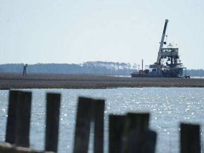
Of 59 Eastern Shore of Virginia waterways studied, 22 are in need of immediate maintenance — and more than one third of channels in the waterways have sections with no more than three feet of depth at mean low water, according to a recently completed report.
Additionally, 81 percent of the waterways studied need permit work before they can make progress toward being dredged. Permits are required before a funded project can be done, but are not sought until after funding is confirmed.
“There isn’t enough money to do them all, so we have to be selective in which ones we want to push,” said John Joeckel, chairman of a regional committee established earlier this year to address the Virginia Eastern Shore’s dredging needs.
The committee’s establishment and the resulting report, “Eastern Shore of Virginia Regional Dredging Need Assessment,” came in response to several factors, Joeckel said — including an ongoing decline in funding to maintain federal waterways on the Eastern Shore of Virginia — in particular the Virginia Inside Passage on the seaside; the removal of most of the U. S. Coast Guard aids to navigation on the Virginia Inside Passage due to the lack of maintenance; and coastal erosion of Virginia’s seaside barrier islands that provide protection from the ocean to the salt marsh, shellfish grounds and the mainland.
“The threat of a reduction in safely navigable waterways, both federal and state, particularly as the tourism and aquaculture industries are growing, is a concern for communities and economies in the region,” the report, “Regional Dredging Needs Assessment,” concluded.
A total of 32 federal project areas and 27 non-federal waterways were evaluated for the report, which the Accomack-Northampton Planning District Commission released after eight months of work.
“With the continued decline in federal funding for maintenance of federal channels and an absence of state and local funding for non-federally designated waterways, the time is upon us to work together diligently to preserve and improve waterway navigability on the Eastern Shore,” said Shannon L. Alexander, Coastal Resources Program Manager for the ANPDC and the report’s principal author.
The study was funded by the Virginia Coastal Zone Management Program at the Virginia Department of Environmental Quality through a grant from the National Oceanic and Atmospheric Administration.
The ANPDC partnered with the Eastern Shore of Virginia Regional Navigable Waterways Committee, of which Joeckel is chairman, and local stakeholders to develop the assessment — deemed necessary in the face of continuing federal budget constraints along with insufficient state funding to maintain non-federal waterways.
The committee was formed with agreement from both Accomack and Northampton County’s Boards of Supervisors. Its membership includes two supervisors from each county, along with residents from each county.
Current membership is, from Accomack County, Supervisor Donald L. Hart Jr.; Supervisor Billy Joe Tarr, Joeckel; Chincoteague Harbormaster Wayne Merritt; Bill Burnham of Onancock; and Accomack County Director of Public Works Stewart Hall.
From Northampton County, members include Supervisor Granville Hogg; Supervisor Larry LeMond; P. G. Ross of the VIrginia Institute of Marine Science; and J. T. Holland of Nassawadox.
“One of the first priorities of the committee has been to work with the (U. S. Army) Corps (of Engineers) on developing a process and funding to develop the regional comprehensive plan, which is in process,” said Joeckel. He called the report that was just released “a first step.”
In addition to federal waterways, state waterways on the Shore are in critical need of maintenance, according to the report.
Virginia dedicates just $1 million annually to maintain all its 3,315 miles of coastline and 3,165 square miles of water. The state is ranked eighth in the nation for total shoreline miles.
Working waterfronts on the Eastern Shore that provide the base of operations for commercial watermen as well as for tourism and recreation, “cannot exist without navigable waterway maintenance providing access to and from those waterfronts,” Joeckel said.
The total value of commercial seafood landings for the two counties in 2014 was around $38 million, according to the Virginia Marine Resources Commission, and the value for Virginia shellfish aquaculture was $48.3 million in 2015, according to VIMS.
Additionally, tourism, which on Virginia’s Eastern Shore is largely centered around activities on or near the water, brought in revenues of over $261 million to the region last year.
On the federal side, projects are evaluated according to their value to the nation — including factors such as commerce, safety and public health, national, state and local security, recreation, environmental factors, and consequences if a project is not dredged — as well as their direct commercial value.
About 69 percent of the region’s federal waterways do not currently meet authorized depths and 10 have sections with less than two feet of water at mean low water, the report found.
Almost half — five out of 12 — of non-federal Waterway on the Coast of Virginia connecting waters have sections with no more than three feet of water at mean low water, as well as a third of non-federal waterways that are not connecting waters to the Waterway on the Coast of Virginia.
The assessment was based on Army Corps data and survey maps, along with previous reports, personal communication with committee members and waterway users and aid to navigation charts.
The hope is the report will be used to help create and implement a comprehensive strategic dredging plan for the Eastern Shore of Virginia.
Among the report’s recommendations is developing such a plan, along with creating a database of waterways to be updated as new information about their condition becomes available.
Another recommendation is to take steps to increase state funding for waterway maintenance.
The report also recommended that the Eastern Shore try to coordinate its priorities with other regions in the state, especially the Middle Peninsula. This would maximize the Army Corps’ dredging schedules and allow for efficient use of the dredge once it enters the Chesapeake Bay.
Development of a strategic plan, to be called “The Eastern Shore Shallow Draft Navigation and Regional Sediment Management Plan,” is the next step for the waterways committe, Joeckel said, adding he hopes to see to completed by mid-2017.
Discussions are ongoing between the Army Corps and the committee to develop the plan, which will schedule and prioritize waterway projects on the Shore for the next five to 10 years, along with giving estimated costs for each.
A regional approach among other advantages could help manage spoils and treat them as a resource, which could save money and help address erosion problems, among other positive outcomes the report posits.
The Army Corps has set a meeting at the Virginia Institute of Marine Science in Wachapreague on Dec. 6 to discuss the feasibility of using dredged material in one location, Cedar Island, to reduce coastal erosion rates and provide shoreline protection to the town of Wachapreague.
Source: delmarvanow


