
Posted on June 19, 2017
By Pat Johnson, The SandPaper.net
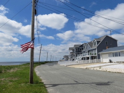
Residents of Tuckerton and Little Egg Harbor still have time to comment on a plan to dredge local creeks and lagoons and use the dredge fill in an area for marsh and storm protection.
The material dredged from Thompson, Tuckerton and Rose creeks and several low areas in lagoons located in Tuckerton Beach and Osborn Island in Little Egg Harbor would be deposited in areas of degraded tidal marsh off Great Bay Boulevard and also to create a living shoreline at the end of Iowa Court in Little Egg Harbor.
Approximately 151,350 cubic yards of suitable dredged sediment would be spread by thin layer deposition over 50 acres.
The Army Corps of Engineering is taking public comment until June 25. Comments on the proposed work should be submitted in writing to the District Engineer, U.S. Army Corps of Engineers, Philadelphia District, Wanamaker Building, 100 Penn Square East, Philadelphia, Pa. 19107-3390.
A public meeting with the New Jersey Department of Environmental Protection, Army Corps and the 9th District representatives of Sen. Chris Connors, Assemblyman Brian Rumpf and Assemblywoman DiAnne Gove is scheduled in Stafford Township at the Bay Avenue Community Center on Tuesday, June 20 from 10 a.m. to noon.
BRS, New Jersey Future and T&M Associates are the principals working on the Tuckerton/Little Egg Harbor project also known as the NFWF project, financed by a $2.1 million grant given by the National Fish and Wildlife Foundation. In April, the towns announced that there was a $2 million shortfall due to additional environmental tests and changes to the deposit location for the dredged material.
They are currently seeking additional funds including $1,595,000 from a DEP Water Quality Restoration grant and $1 million from the National Oceanic and Atmospheric Agency. The project cannot begin until T&M receives signed permits from the DEP and Army Corps.
According to the applications to the DEP and Army Corps, the detailed waterways to be dredged include Thompson Creek, sections of manmade lagoons adjacent to Tuckerton Beach, Tuckerton Creek, including sections of adjacent manmade lagoons, Rose Creek, including sections of adjacent manmade lagoons; Mystic Island Northwest Channel plus sections of adjacent man-made lagoons; Mystic Island Southwest Channel, including sections of adjacent manmade lagoons; manmade lagoons adjacent to Osborn Island; Ocean Boulevard channel and Ocean Boulevard access channel.
Waterways associated with the transport of dredged material by pipe include Great Bay, Little Thorofare, Jimmies Creek, Bogans Cove, Big Creek, Marshelder Channel, Horsefoot Cove, Big Thorofare, Tuckerton Cove, Tuckerton Bay and Edge Cove.
A living shoreline is proposed at the end of Iowa Court, on Block 326, Lot 28.01 in Little Egg Harbor. Sediment enrichment is proposed along Great Bay Boulevard, Block 326, Lot 61; and Block 327 Lots 33 and 34 in Little Egg Harbor.
The applicant proposes to hydraulically dredge accumulated sediment from within portions of the first eight waterways listed above as well as portions of adjacent manmade lagoons.
Most of the proposed dredging areas have previously been dredged. The Corps is currently reviewing whether state and federal authorizations were made for previous dredging projects. Shoaling has impeded navigation within these important channels.
The maintenance dredging project is intended to restore these channels to the authorized project dimensions to allow safe passage for recreational and commercial marine traffic.
There are five sediment enrichment areas of degraded tidal salt marsh along Great Bay Boulevard consisting primarily of spartina marsh grass and salt meadow cord grass. The dredge material consisting of silt, clay and sand will be deposited within the marsh areas that are completely inundated after the tide recedes. These tide pools are continuing to grow in size as vegetation dies off due to constant inundation.
The proposed height of the sediment layer will be based on the initial elevation at each location and the target elevation for optimal high salt marsh growth, generally between 1 and 2 feet. The sediment deposition areas would be planted with spartina once the sediment has stabilized.
Dredging barges would pump sediment from the bottom of the designated dredge channels through an 8- to 10-foot polyethylene pipeline. The dredge discharge pipe would utilize booster pumps to assist in pumping the dredge material to its destination. The pipeline would be floated over water except where it crosses over navigation channels, where it would be sunk in order to avoid interference with vessel and watercraft traffic.
The project also includes the design of a living shoreline to include construction of a stone breakwater measuring 385 linear feet, construction of four wooden breakwaters measuring 30 linear feet each, placement of 1,350 cubic yards of clean sand, and planting of spartina. The applicant proposes to temporarily place a super silt fence, hay bales and turbidity barriers around the sediment placement areas to contain the deposited dredge material.
Copies of the permit applications including maps of the proposed dredge and marsh restoration areas may be viewed at municipal clerk offices in Little Egg Harbor and Tuckerton.
Source: The SandPaper.net


