Posted on May 30, 2016
By Trevor McDonald, Hannibal Courier-Post
A bi-partisan bill that could bolster a comprehensive plan for the Upper Mississippi River region moved closer to fruition, after passage by the U.S. House of Representatives Transportation Committee on Wednesday, May 25.
The Water Resources Development Act of 2016 (WRDA) would preserve funding for the United States Army Corps of Engineers’ Upper Mississippi River Comprehensive Plan and a variety of water-related projects. Communities along the Mississippi River could receive benefits — from community protection through levees to navigation proposals — as the bill heads to the U.S. Senate.
According to govtrack.us, the bill’s prognosis for being enacted is 22 percent. About 21 percent of bills that made it past committee in the previous 2013-2015 Congress were enacted.
Working toward bolstering U.S. waterways
The bill’s goals include improving harbors and rivers and providing “conservation efforts and development of water and and related sources.” One proposal in the bill specifies inspections and reports of the condition of all federal breakwaters that protect harbors and inland harbors. Eight plans are slated in the bill for flood risk management, hurricane and storm damage reduction and navigation — including a navigation plan for the Mississippi River Ship Channel in the state of Louisiana.
Republican Rep. Sam Graves (MO-6) said that levee projects and other waterway development would bring increased safety and productivity to people in his district.
“Two of America’s major rivers run through North Missouri and the district I represent in Congress,” Graves said. “These rivers help support thousands of jobs and millions of dollars in agriculture exports, but flooding and outdated waterway infrastructure could jeopardize all of that. I’m glad to see the WRDA bill clear the Transportation Committee with specific policies to fund levee projects, protect homes and businesses, and support Missouri’s agriculture industry.”
Upper Mississippi River Comprehensive Plan’s impact in NEMO
The Upper Mississippi River Comprehensive Plan was drafted in 2008 spurred by the lost lives and property during Great Flood of 1993. The study examined ways to minimize flood damage, looked at proposed structures to stop flooding and compared geographic characteristics — including regular flood-risk measurements — in each of the 78 counties that make up the Upper Mississippi and Illinois Waterway. Five percent of the nation’s population lives in this region, and the plan could affect Northeast Missouri communities in numerous ways, should the Senate, and eventually the President, approve the WRDA.
UMIMRA seeks unified plan, parity with river’s southern portion
Upper Mississippi, Illinois and Missouri Rivers Association (UMIMRA) Executive Director Meagan Kaiser said her group represents stakeholders in Iowa, Illinois and Missouri. She said UMIMRA members seek a unified plan of systemic flood measurement, like what’s in place for the southern portion of the river. Members also support a revision of the 2008 Upper Mississippi River Comprehensive Plan draft, using the latest scientific advancements to reassess each region.
For area farmers, controlling where flood waters end up is vital — 100,000 acres of flooded corn farmland means 1 million people can’t receive the kilocalories from those crops. Kaiser said a strong plan for land rehabilitation and flood management would pay off economically, with the Tennessee Valley Authority reporting that each dollar spent for flood control generates five dollars in economic growth.
“There’s so much possibility here,” she said.
Louisiana sees possibility for increased riverfront development
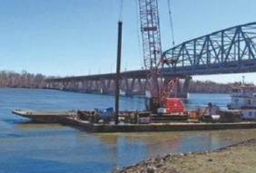
Darrell Hampsten, Director of Economic Development for Louisiana, said an increased focus on the locks and dams marked “good news for the region.” He also pointed out that the railroad bridge spanning the Mississippi River is a rare swing bridge, which opens to create a smaller channel for barges than other designs.
Louisiana City officials have been considering riverfront development plans, which could benefit from the WRDA.
“Pike County is a port authority now, and we’re trying to develop the riverfront,” Hampsten said.
Potential for protection, economic impacts cited by Clarksville Mayor
Clarksville Mayor Jo Anne Smiley said the WRDA would provide impact in protecting the town and bolster industries that stretch far beyond the Mississippi River. Clarksville faces and is situated directly on the Mississippi River. It is one of the communities most prone to flooding on the upper Mississippi.
To preserve the downtown area’s picturesque views of the river, a permanent flood wall was out of the question. Since 2008, city officials have been seeking funds for a modular, $3.5 million EKO flood wall system. Smiley said that stackable sections — similar to Lego building blocks — can be assembled to the required height by city staff within one day. Vertical metal columns support the stackable portions, and components can be stored in a fenced-in area when not in use, Smiley said.
“If we could do that, we could protect the downtown,” she said.
Smiley said that the Upper Mississippi River Comprehensive Plan and the WRDA could help strengthen our nation’s harbors, locks and dams. The plan could also relieve flooding in Pike, Lincoln and St. Charles counties. Smiley said the WRDA would guide the U.S. Army Corps of Engineers in their waterway tasks.
Far-reaching impact
Smiley stressed the Mississippi River’s importance beyond the Upper Mississippi River area. Billions of dollars worth of goods and services move up the river, on their way to every corner of the country. Smiley said the Mighty Mississippi would continue to provide for the entire nation “if we do it right” and follow recommendations set forth in the U.S. Army Corps of Engineers’ plan.
“It can take care of the country,” she said. “But if we don’t, we’ll lose.”
Source: Hannibal Courier-Post


