
Posted on April 29, 2019
Out on the east coast of Staten Island, one of New York City’s first major responses to the existential threat of climate change may soon break ground. This March, the last bit of bureaucratic red tape was cleared away for the construction of an enormous 5.3-mile long barrier that will stretch from Fort Wadsworth to Oakwood Beach. The United States Army Corps of Engineers (USACE) is now planning to break ground on this $615 million project in 2020, and expects it to be finished in approximately four years.
Officially known as the South Shore of Staten Island Coastal Storm Risk Management Project, the USACE’s barrier is staggering in scope. It will include a 4.3-mile seawall with a public promenade built on top, one mile of levees and floodwalls, and more than 180 acres of newly excavated stormwater detention ponds. The project encompasses an area with over 30,000 residents and 7,300 structures, and will protect some of the coastal neighborhoods that suffered the worst damage during Hurricane Sandy, including Arrochar, South Beach, Ocean Breeze, Graham Beach, Midland Beach, New Dorp Beach, and Oakwood Beach.
“The project is designed to reduce risk of flooding and damage from severe storms such as nor’easters, hurricanes, and other weather events that involve tidal surges. Specifically, the project is designed to function under a storm producing water levels of a 300-year flood event (a storm with a 0.3 percent chance of occurring in any given year),” Frank Verga, the USACE project manager, says via email. “It provides a complete solution incorporating project features to address flooding not only due to coastal storm surge, but also due to precipitation.”

When Hurricane Sandy hit New York City in 2012, the neighborhoods closest to the seawall site were badly damaged, as the ocean surged through the streets, crushing homes and killing 24 Staten Island residents. For the communities that remain intact along this section of the coast—including Arrochar, Midland Beach, and New Dorp Beach—the USACE barrier system cannot be built soon enough. Many of the flood-damaged houses in these neighborhoods have remained empty since the storm, waiting to be repaired, demolished, or elevated up above the floodplain, while the temporary coastal barriers that were put in place have already begun to collapse and erode into the sea. If another major storm were to come today, some of these same neighborhoods could be flooded again.
Unfortunately, the Staten Island seawall will not arrive in time to save all of the areas situated in its shadow. Three of the communities immediately adjacent to the barrier—Ocean Breeze, Graham Beach, and Oakwood Beach—have been almost completely demolished as part of a “managed retreat” away from the waterfront. This buyout program was facilitated by New York state’s Office of Storm Recovery, and has helped to relocate hundreds of Staten Island homeowners away from the coast. No new structures can be built on these properties in the future, and a large portion of the land that will be protected by the new seawall is already permanently uninhabited, populated only by deer, geese, possums, and turkeys.

Despite the USACE’s extensive research, exactly how much protection the barrier will be able to provide in the future remains uncertain, as sea levels continue to rise at an increasing rate. The seawall is intended to protect the coast from a storm surge of “about two feet higher than the peak water levels during Hurricane Sandy,” according to a 2016 feasibility report, and is designed to account for “an intermediate rate of sea level rise of 1.1 feet” over the next 50 years. This is a remarkably lower intermediate rate of sea level rise that what is anticipated by the New York state Department of Environmental Conservation, which expects between 1.5 feet and 6.25 feet of sea level rise to occur in the next 81 years.
As news comes in that the USACE’s $14 billion barrier system around the city of New Orleans is now sinking and may soon be inadequate, despite being completed just 11 months ago, the USACE openly acknowledges that their planned barrier in Staten Island may also need to be raised up higher in the future, as sea levels continue to climb. “Since the project is comprised of primarily hard structures, they are designed to last indefinitely as long as properly maintained. In the future, the project can be modified for potential sea-level rise,” according to Verga.

The Staten Island seawall is just the first of several enormous projects that are nearing the construction phase along New York City’s waterfront. The USACE is also working towards selecting its final plan for the NY & NJ Harbor & Tributaries Focus Area Feasibility Study, where it will be deciding between five different proposals for a system of storm surge barriers and levees to be built around the entire New York waterfront. These proposals range in cost from $15 billion to $118 billion.
The East Side Coastal Resiliency Project is also now moving forward, and is projected to be completed by 2023, at a cost of $1.45 billion. This project will protect a stretch of Manhattan’s coastline from Montgomery Street on the Lower East Side up to East 25th Street, and includes a controversial new proposal to shut down the East River Park for 3.5 years, in order to raise the park’s elevation eight to ten feet higher.
And this past March, Mayor Bill de Blasio announced a $10 billion plan to protect lower Manhattan from storm surges and sea level rise. His proposal includes extending the shoreline of the island up to 500 feet out into the Hudson River and the East River, in order to “create a new piece of land with high points at or above 20 feet from current sea-level.” Yet despite its hefty price tag, this project would only secure Lower Manhattan from rising seas through 2100, according to a New York magazine piece by de Blasio.
“We’re going to build it, because we have no choice,” the piece reads. “This country has wasted too many years pretending it had the luxury of debating climate change. The national emergency is already here. We have to meet it head-on.”
It is both encouraging and terrifying to see these proposals moving forward. On the one hand, it is heartening to know that the city, state and federal governments are all finally beginning to take concrete actions to address the existential threat of climate change. On the other hand, despite the enormity of these proposals, and the long-term changes they will inflict to our coastline, all of these projects may prove to be merely short-term solutions, underscoring the reality that New York City is facing a very tenuous future. Hopefully, some part of our coastline will survive the rising waters.

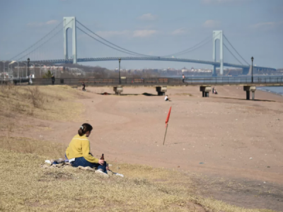
The proposed site for the USACE’s new Staten Island seawall begins just south of Fort Wadsworth and the Verrazano-Narrows Bridge, in an area that is currently protected by a low sandy berm.

The 1.4-mile-long Franklin D. Roosevelt Boardwalk also begins here, next to the sandy berm. The entire boardwalk will be dismantled and replaced with a 2.5-mile-long section of buried seawall and armored levee, which will rise approximately 20 feet above sea level, and which will have a new 38 foot wide boardwalk constructed on top. This section of seawall will stretch down to Midland Beach.

The Roosevelt Boardwalk is the last wholly intact wooden boardwalk left in New York City. Most of the Rockaway Boardwalk and large sections of Coney Island Boardwalk were replaced with concrete and other materials after Hurricane Sandy.

The boardwalk currently looks out over a sand dune barrier and onto the Atlantic Ocean. During Hurricane Sandy, seawater surged up over the beach here, before rushing across Father Capodanno Boulevard and down into the nearby neighborhoods.

Parallel to the boardwalk, a long row of houses has been built along Father Capodanno Boulevard, an elevated street that runs alongside 2.5 miles of shoreline. Many of the homes beyond the boulevard are situated in a low-lying area, which was filled with floodwaters like a bowl during Hurricane Sandy.


Numerous homes in South Beach have been built directly into wetlands, and are surrounded by rivers, ponds, and lakes. This South Beach housing complex, ironically named Crestwater Court Community, sits between three bodies of water in the South Beach Pond Preserve and the South Beach Bluebelt, and is located about 1,000 feet away from the ocean. The USACE proposal includes excavating an even larger 19-acre pond around this complex, called Drainage Area E.


In Arrochar, homes damaged by Hurricane Sandy remain empty. This property located on a street named Sunnymeade Village was flooded by approximately eight feet of seawater. The floodline is visible in the photograph on the left, taken in November 2012. The home is now owned by Project Rebuild, a not-for-profit associated with the city’s Build It Back program.

The wooden section of the Franklin D. Roosevelt Boardwalk ends near an elevated bluff, across from the neighborhood of Ocean Breeze. The bluff, constructed on a base of leaking TrapBags, is now collapsing into the ocean.

To the south of the boardwalk, a 1.1-mile stretch of coastline is currently protected by a low sandy barrier, approximately six feet high, which runs next to a wide pedestrian promenade. This promenade and barrier would also be replaced by the USACE’s 2.5-mile section of seawall topped with a boardwalk.

Inland from the promenade, the neighborhood of Ocean Breeze has now been almost completely demolished as part of a “managed retreat” from the coastline. Just a handful of homes remain. Located immediately adjacent to Father Capodanno Boulevard, Ocean Breeze was severely damaged by Hurricane Sandy.

The buyout program is also nearing completion in Graham Beach, a neighborhood just south of Ocean Breeze. Entire city blocks are now almost completely empty here, and will not be built up again.

In Midland Beach, the low-lying streets were also badly flooded when the ocean surged down from Father Capodanno Boulevard. “The neighborhood turned into a lake that was more than nine feet deep in some places,” according to the New York Times, and the floodwaters drowned eight residents.

Further inland, the New Creek Bluebelt is now nearly complete. This recently upgraded stormwater management system features several new holding ponds, culverts and stormwater detention basins, which flow through Midland Beach and Graham Beach. The USACE project proposes excavating seven ponds across 100 acres within this newly rebuilt waterway, which it calls Drainage Area C.

The current coastal defenses along the boardwalk and promenade end abruptly just to the north of Miller Field, where a low sand dune is all that keeps the ocean out of Midland Beach. The 2.5-mile section of the USACE seawall topped with a boardwalk would also end here.

The final hurdle for the USACE project was cleared in March, when the Natural Resources Management Act was signed into law. This lengthy document included a key piece of legislation by freshman Congressman Max Rose (who represents Staten Island and parts of Brooklyn), which gave the USACE access to build in Miller Field, an area protected by the National Park Service.

The USACE project would demolish this WWII-era lookout tower, as part of erecting a 1.75-mile-long stretch of buried sea wall here that will be topped with a 17-foot-wide promenade. This promenade would extend south to Oakwood Beach.

The seawall would protect the historic hangars of Miller Field, which is part of the Gateway National Recreation Area, and would also extend protection to the distant homes of New Dorp.

In New Dorp Beach, a temporary barrier erected after Hurricane Sandy is eroding into the ocean. The TrapBags here have burst open in the face of high tides.

During Hurricane Sandy, the storm surge pushed through this narrow strip of parkland and into the low bungalows of New Dorp Beach, causing widespread damage.


Many homes here were destroyed by the storm, like this property at Cedar Grove Avenue and Maple Terrace, photographed in November 2012. In 2016, the Governor’s Office of Storm Recovery helped facilitate an auction of storm-damaged homes they had purchased throughout the neighborhood, with the stipulation that they be rebuilt and elevated above flood levels. This same property now contains a house that towers over its abandoned neighbor.

To the south of New Dorp Beach, the coastal protections currently includes this long, elevated row of TrapBags along the waterfront of Oakwood Beach. Many of the bags have burst, leaving behind an unstable, dangerous pathway. The USACE project would replace this coastal defence with the section of seawall topped by a 17-foot-wide promenade, as well as 46 acres of tidal wetlands on the coast, including 10 acres of maritime forest and 19 acres of marshland.

Behind the seawall, the USACE plans to excavate a 46-acre stormwater detention pond, tearing out an Oakwood Beach marshland populated by hawks and deer, which it describes as mainly a “Phragmites monoculture low quality wetland habitat.”

Along Kissam Avenue, the phragmites have taken over from the wetlands mix that was planted as part of the state’s managed retreat. Hurricane Sandy destroyed 13 homes on this street, and the Governor’s Office of Storm Recovery demolished the rest as part of its buyout program.


Just two homes remain standing on Kissam Avenue, both empty. The new seawall will be completed too late for the residents of this street, who have all been relocated to different communities. The land acquired by the state in Oakwood Beach will remain uninhabited.

At the southern end of Oakwood Beach, the USACE plans to build a two earthen levees and a concrete flood wall, to help protect the Oakwood Beach Wastewater Treatment Plant. The plant is one of the few structures remaining in the neighborhood, where only a handful of homes still stand.

How long the new USACE levees here will last is uncertain. The current landscape at the end of Oakwood Beach includes an array of older wooden, concrete, and stone barriers, which are all slowly eroding as the ocean inexorably chips away at the coast.
Nathan Kensinger is a photographer, filmmaker, and curator who has been documenting New York City’s abandoned edges, endangered neighborhoods, and post-industrial waterfront for more than a decade. His Camera Obscura photo essays have appeared on Curbed since 2012. His photographs have been exhibited by the Museum of the City of New York, the Queens Museum, the Brooklyn Museum, the NYC Parks Department, and inside the Atlantic Ave-Barclays Center subway station.
Source: ny.curbed.com


