Posted on April 6, 2020
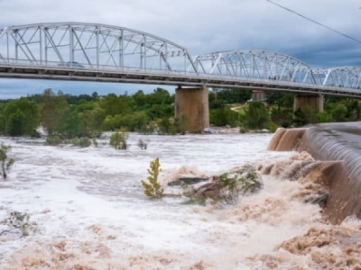
Abundant rainfall and flooding could impact freight flows in large portions of the United States this spring, including some areas devastated by major flooding in 2019.
Forecasters at the National Oceanographic and Atmospheric Administration (NOAA) have predicted widespread flooding, but they do not expect it to be as severe or as prolonged as the historic floods last year in dozens of states along the Mississippi, Missouri and Arkansas rivers. They said major to moderate flooding is likely in 23 states from the Northern Plains to the Gulf Coast, with the most significant flooding potential in parts of the Dakotas and Minnesota.
Spring flood risk
Snow melt, highly saturated soil and an enhanced likelihood for above-normal precipitation this spring will contribute to the increased chances for flooding across the central and southeastern United States. A risk of minor flooding exists across one-third of the country.
The greatest risk for major and moderate flood conditions includes the upper and middle Mississippi River basins, the Missouri River basin and the Red River of the North. The upper Mississippi River basin runs from St. Louis, at the confluence of the Mississippi and Missouri rivers, to central Minnesota; the middle Mississippi River basin runs from St. Louis to Cairo, Illinois, at the confluence of the Mississippi and Ohio rivers; and the Red River of the North runs from Wahpetin, North Dakota, into Manitoba, Canada, forming most of the border between North Dakota and Minnesota.
In fact, river gauges at many locations along the Red River of the North, from Fargo, North Dakota, to the Canadian border, are at moderate or major flood stages as of Thursday. This is due to recent early-season warmth, snow melt and rainfall. According to NOAA’s Advanced Hydrologic Prediction Service, these areas will remain at these levels for at least the next week. National Weather Service (NWS) flood warnings can be seen in the FreightWaves SONAR Critical Events platform.
SONAR Critical Events: Thursday, April 2, 2020, 3 p.m. EDT
Moderate flooding is anticipated in the Ohio, Cumberland, Tennessee and Missouri River basins, as well as the lower Mississippi River basin (from Cairo to the Louisiana coast) and its tributaries.
“Nearly every day, dangerous flooding occurs somewhere in the United States and widespread flooding is in the forecast for many states in the months ahead,” said Ed Clark, director of NOAA’s National Water Center in Tuscaloosa, Alabama. “Working with our partners across the National Weather Service we provide the best available forecast products to enhance resilience in communities at greatest risk.”
Ice is on the move! Warmer spring temperatures mean melting ice across the Upper-Midwest, leading to scenes like this out of Minnesota. Melting ice could lead to ice jams and flooding on rivers. Read more about the spring flood outlook here: https://t.co/wK2bAsuAk0 #MNwx pic.twitter.com/vug4BKfChx
— WeatherNation (@WeatherNation) April 2, 2020
With soil moisture already at high levels across much of the central U.S., and many rivers running high in the central and eastern U.S., any excessive local rainfall could cause new or additional flooding in these high-risk areas. The flood risk outlook is based on an integrated evaluation of various factors, including current conditions of snowpack, drought, soil moisture, frost depth, streamflow and precipitation.
“People depend on the National Weather Service’s river forecasts, and the accurate and timely streamflow data from more than 8,400 streamgages operated by the U.S. Geological Survey (USGS) throughout the country play an integral part in making those forecasts,” said Bob Holmes Jr., Ph.D, USGS national flood coordinator. “These streamgages report information like when streams have reached flood stage or even when they break streamflow records. That kind of data allows the National Weather Service to bring the best science to bear for their forecasts.”
Impact on freight
Beginning in mid- to late March last year, hundreds of river gauges from the Midwest and Great Plains southward to the Gulf Coast remained at major flood stages for months due to excessive rainfall. Flooding dramatically impacted transportation and freight flows on roads, rails and waterways. Barges full of grains harvested just prior to the floods couldn’t get to the Gulf Coast for export. Some of these loads, along with some rail freight, end up on trucks. SONAR Tickers: OTVI.URMW, OTRI.URMW
Demand for outbound freight from the Midwest spiked just before the flooding began. This is evident by looking at the outbound tender volume index (OTVI.URMW) in FreightWaves SONAR. At the same time, carriers were rejecting fewer loads (OTRI.URMW) because they were trying to get as much freight out of the regions prior to the onset of the floods. But with millions of acres of flooded and lost crops, overall freight volumes from the Midwest dropped for a couple of months after the flooding began.
NOAA produces seasonal outlooks to help communities, businesses and organizations prepare for weather and environmental conditions that are likely during the months ahead. Heavy rainfall at any time can lead to flooding, even in areas where overall risk is considered low. Extensive, significant flooding could throw freight markets off kilter again.
Source: freightwaves


