Posted on October 31, 2016
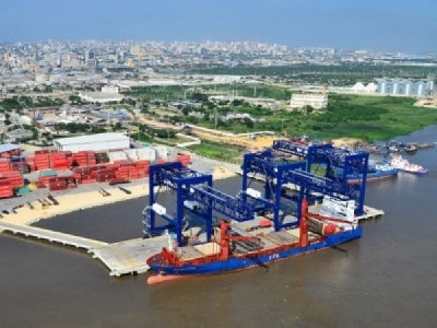
The study Witteveen+Bos recently conducted for Royal Port S.A. in order to ascertain the feasibility of a new port on the mouth of the Magdalena River near Barranquilla, Colombia, shows that the port is technically and nautically feasible. Among other things a nautical simulation, of a magnitude that was never seen before for a Colombian port, was performed for this study. Now that its feasibility has been established, Royal Port is going to acquire the port concession from river management authority Cormagdalena.
The port is intended to handle three main cargo types, liquid bulk, dry bulk and containers. The port will only be accessible (for cargo and personnel) over water to preserve the protected nature reserve Parque Isla de Salamanca on the east bank of the Rio Magdalena; all hinterland transport to and from the port will be by means of inland barges. For this project Witteveen+Bos has joined forces with two subcontractors: the Maritime Research Institute Netherlands (MARIN) and Colombia’s Antea Group. After Royal Port has obtained the required port concession, the next step will be to produce the detailed design of the port.
In the first phase of the project, Witteveen+Bos has investigated the technical feasibility of the planned port using hydrodynamic modelling techniques and a simulation to demonstrate the plan’s nautical safety. Witteveen+Bos experts in the field of master planning and port structures designed and adapted the new port lay-out taking the physical site conditions and the design ship into account. The design ship exists of 200 m length, 32 m beam and 10 m maximum allowable draught. Apart from the liquid bulk jetty, all other port areas/facilities will consist of land reclamations with quay walls. There shall be two berths for the liquid bulk vessels along the liquid bulk jetty. One multi-purpose berth with a length of 300 m (the ‘finger pier’) is planned for the other cargo flows. The bed level of the navigable water areas (including the turning circle with a diameter of two times the length of the design vessel) of the port shall be the same as in the main navigation channel of the Rio Magdalena: -40 ft CD (or -12.19 m CD). Along the southern side of this land reclamation a quay wall for the inland barges for further (river) transport will be constructed. This lay-out provides various options for future expansion. The quay of the ‘finger pier’ and the strip of land can be extended in northerly direction. Alternatively, it might be possible to create a quay wall along the eastern edge of the storage area so that vessels can berth at either side of the ‘finger pier’.
A hydrodynamic and morphological study of the Magdalena River, Caribbean coast and port location was performed to know the boundary conditions for the port and its nautical simulation. Two pilots from Barranquilla performed the nautical simulation of the design ship at the nautical simulation centre of MARIN in Wageningen, the Netherlands. Manoeuvres to and from Royal Port can be carried out safely with the considered design ship. This was the first time a nautical simulation of this magnitude was performed for a Colombian port. It was also investigated how international environmental and waste MARPOL- and IMDG-regulations are to be implemented in the port concept.
Source: O&GLinks


