Posted on November 6, 2018
There is a great deal of active and formerly active agricultural land along the major rivers in Vermont. In some cases, this land has been farmed for 200 years or more. Phosphorus, in various forms, has been applied throughout the active farming periods, including the period when governments encouraged and subsidized high rates of phosphorus addition. Soil containing this phosphorus has been continually eroding into the streams. The amount of phosphorus-laden sediment that entered the waterways during Tropical Storm Irene alone was enormous. More is added with each spring runoff and major storm event, exacerbated by the scars left by Irene.
As these lands erode, phosphorus-laden sediment enters the water and slowly makes its way to Lake Champlain. This legacy phosphorus’ long march to the lake ensures that even if all Vermont farms and properties were in 100 percent compliance with the existing standards and regulations, water quality in the major rivers would only very slowly improve from upstream to downstream and likely the lake’s water quality would not improve over most of our lifetimes.
This predictable lack of visible progress will likely spawn more lawsuits, legislation and regulations. The hostility towards the farmers and “the State” as evidenced at some of the uncomfortable public meetings last spring, will increase as Vermonters perceive a “waste” of a significant amount of their money on this issue.
Unfortunately, there will also be an undermining of the credibility of the state as a result of the government’s trust and reliance on computer modeling. As expensive projects are implemented and data is plugged in, the official numbers will show significant reductions in pollutants, including phosphorus. However, the people will see no corresponding visible betterment of water quality in the lake.
Even if accurate, that modeling only considers the improvement in water quality of the runoff itself. The implication and the public’s natural, albeit unrealistic, expectation will be that the receiving waters’ quality and water quality in Lake Champlain will be improved in tandem, which will not be true due to the presence of, and continual migration of the legacy phosphorus.
In Vermont, significant erosion of river banks continues generally unabated due in no small part to the long-standing and entrenched regulatory bias against streambank stabilization.
While the state may encourage and even subsidize streambank stabilization in the form of tree planting, the general policy is to let the streams run wild. There are valid arguments to support this policy based on stream ecology. However, exceptions can be made to allow armoring of the streambank for certain purposes such as protecting critical infrastructure. Consideration should be given to exceptions to allow for the protection and remediation of water quality in Lake Champlain. Many of the areas of greatest risk of agricultural erosion are too steep or too dynamic to be stabilized with tree planting.
Which leads to the consideration of another bias. The opposition to dredging.
There was some limited acceptance of sediment removal by the state shown in a proposed project near Lake Carmi involving what is described as “a man made pond” (presumably not considered “waters of the state)”. Although this may be taken as the state’s acknowledgement that physically removing phosphorus from the water results in less phosphorus in the water, the state’s position has been, and seems to remain, strong opposition to dredging “waters of the state.”
Even if dredging was endorsed, it would be financially and logistically impossible to remove the legacy phosphorus along the lengths of the rivers going into Lake Champlain.
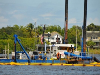
In order to determine if there might be a feasible and affordable approach, a pilot sediment removal station could be set up across the width of a river near a discharge point. The test site would be selected based primarily on stream velocity, as the slower moving water drops out more sediment. The depth of the most heavily contaminated phosphorus laden sediment could be determined by sampling, measured and removed with suction dredging or an air-lift which minimizes disturbance of the adjacent sediment. Depth level sensors would then track sediment buildup, and that same area cleaned again when indicated by additional sediment accumulation and testing. This would intercept the phosphorus before it enters the lake.
The actual amount of phosphorus removed, based on sediment concentration sampling and sediment volume removed, would be easily quantified and documented. Of course, this would not address the phosphorous already in the lake, but it would help to reduce and ultimately reverse the rate of further deterioration. The removed nutrient-rich material could likely be beneficially re-used, assuming regulatory cooperation.
The active removal of phosphorus-laden sediment from a waterway seems to be more accepted in the United States than it is in Vermont. There is a large-scale phosphorus removal project underway in the Lake Mendota watershed in Dane County, Wisconsin (see exec.countyofdane.com/cleanlakes.aspx for a short summary). There have been many successful projects involving dredging to reduce legacy phosphorous elsewhere in this country and around the world.
Such a project is easy to understand, relatively inexpensive and can show documentable results quickly. If it proved to be effective, the public, the Legislature and perhaps even the regulators in Vermont might be supportive.
The legacy phosphorous issue needs to be fully on the table and discussion held as to what, if anything, the state should, is willing to, and can afford to do to address this issue.
Source: VTDIGGER


