Posted on January 22, 2019
A century after the Kankakee River was dredged and straightened in Indiana, it’s more prone to flooding than ever.
However, the preliminary report on a plan to relieve some of the flooding received a lukewarm reception at a recent Kankakee River Basin Commission meeting.
The plan called for a combination of measures, such as stabilizing some river banks and allowing some areas to flood.
“This is a river, and the management of it needs to be thought of that way,” said Siavash Beik, one of the plan’s authors. “Our suggestion is to have a new path.”
Eventually, KRBC members agreed to ask the Indiana Legislature this year for about $850,000 to stabilize the riverbanks along the Kankakee and the Yellow rivers, its Indiana tributary.
“We knew there were going to be disagreements (about the plan),” said Scott Pelath, the KRBC’s new executive director and a former state legislator from Michigan City.
He suggested looking for areas of agreement in the plan, and said it would be important to ask the legislature for funding in this year’s budget session.
After last year’s flood, one of the worst in the river’s history, a group of legislators said a new plan to address Kankakee River flooding is needed.
The plan is being drafted by Beik, vice president and principal engineer for Christopher B. Burke Engineering LLC, and Bob Barr, a research scientist in the Center for Earth and Environmental Science at Indiana University-Purdue University Indianapolis.
The report’s final version, which will include Kankakee and Iroquois counties in Illinois, is expected in May or June. Previous plans have focused only on Indiana’s part of the river.
When Indiana’s slow-moving, meandering Kankakee River was channeled in the late 19th and early 20th centuries, Barr said, “It left you with the situation you still struggle with.” The Illinois part of the river has remained natural.
Homeowners Steve Connor and Mike Cunningham continue the battle to keep Kankakee River floodwaters at bay Feb. 23, 2018, in Shady Shores. (Carrie Napoleon/Post-Tribune)
Land that had been part of the vast Kankakee marsh in Indiana became fertile farmland, but flooding has increased there in recent years. More than a dozen floods have happened in the past four decades. Last year, water stood on some farm land for two months.
Flooding has increased for several reasons, Beik said: more frequent intense rain storms, more water runoff from urban areas and farm fields, and sediment coming into the river. The greatest source of sediment, he said, is from eroding “spoils banks” – piles of material dredged from the river – along the Kankakee and the Yellow rivers.
The river channel itself is stable, Beik said, and dredging would only create more instability. An Indiana proposal to dredge the Kankakee in the 1970s was blocked by an Illinois lawsuit.
It’s also not feasible, Beik said, to contain the river in its narrow corridor when water surges in after intense storms.
The plan’s recommendations, to be carried out over a 20-year period, include reducing sediment from the Yellow River – the main source of sand in the Kankakee during floods – by covering riverbanks with plants; protecting roads and other critical areas, such as sewage treatment plants and large subdivisions, from high water; removing or replacing an old bridge that impedes water flow; allowing some areas, such as the Kankakee Fish and Wildlife Area in Starke and LaPorte counties, to flood; and creating water-detention areas in drainage ditches that feed the Kankakee.
After the presentation by Barr and Beik, LaPorte County Surveyor Tony Hendricks proposed tabling the proposed plan, but the motion was defeated.
A subsequent motion to support the report’s recommendation on river bank stabilization was approved.
Also at the meeting, some KRBC members objected to proposed legislation to reduce the commission’s size from 24 members – three from each of the eight counties along the Kankakee and Yellow rivers – to eight.
Several said the reduction would favor politicians at the expense of landowners. The current membership includes a surveyor, county commissioner and soil and water district member from each county.
State Rep. Doug Gutwein, R-Francesville, said House Bill 1270, as introduced, would not include an assessment system for funding the KRBC, which now depends on money from the legislature.
KRBC Chairman Chris Knochel, the Newton County surveyor, said an assessment system would allow the KRBC to work on river projects without depending on the state. Others have noted that a property assessment system was instituted in the Little Calumet River watershed in northern Lake County after a devastating flood in 2008.
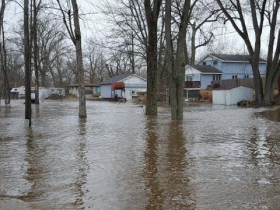
A Kankakee River levee break in Jasper County on Friday, Feb. 23, 2018, flooded a nearby subdivision, bringing water to the doors of homes and flooding exterior buildings like storage sheds and garages. (Carrie Napoleon/Pioneer Press)
Tim Zorn is a freelance reporter for the Post-Tribune.
Source: Chicago Tribune


