
Posted on March 14, 2019
Photo: Marinas.com
It’s not a full deepening of Jekyll Creek, but a $6 million pilot project that could lead to further work is underway with actual dredging set to begin April 10.
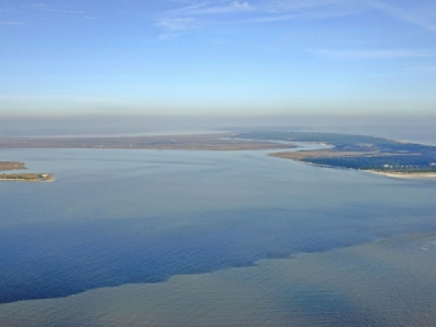
According to the state Department of Natural Resources’ Coastal Resources Division, Cottrell Contracting, a firm out of Chesapeake, Va., is to remove 200,000 cubic yards of muck in the eastern 75 feet of the channel, north of the Downing Musgrove Causeway. The creek, which is part of the Atlantic Intracoastal Waterway, hasn’t been dredged in 20 years and is the shallowest point in the waterway’s 160 miles through Georgia.
The plan is to figure out the sweet spot in managing the dredge material between economic efficiency and environmentally appropriate. By the time the effort’s finished by mid-May, the channel should be restored to a 10-foot depth.
About 97 percent of the dredge material will go into a natural formation in the St. Simons Sound, about 800 feet south of the St. Simons Pier, called the “Deep Hole,” which is around 60-80 feet deep. This isn’t expected to impact marine traffic through the sound, and the tides will spread the material natually. LG2 Environmental Solutions, from Jacksonville, Fla., is contracted to monitor the area for up to two years.
The other 3 percent of sediment gets sprayed across the nearby marsh in two areas in late April, using a method called “rainbowing,” which will handle about 5,000 cubic yards of material.
“The sediments will be sprayed into the marsh onto a five-acre area in a thin layer surrounded by coconut-fiber containment logs,” according to CRD. “The goal of spraying dredge sediments into this area is to raise the elevation 1-2 inches in some places and up to 1 foot in others, allowing new marsh grass to grow atop it at higher elevations.”
Another area nearby will serve as the control area, and scientists from Georgia Southern and the University of South Carolina will monitor both areas for two years to see how the “thin-layer placement of sediments” affects the marsh.
Included in this effort are CRD, the Jekyll Island Authority, the Army Corps of Engineers, the National Oceanographic and Atmospheric Administration, the U.S. Fish and Wildlife Service, the Environmental Protection Agency and The Nature Conservancy.
The view from camera on the site erected through a partnership between the JIA and The Nature Conservancy can be seen at https://is.gd/jekyllcamera.
Source: Thebrunswicknews.com


