Posted on February 18, 2019
MERCEDES — A new hydraulic model for flood mitigation along the Arroyo Colorado is raising significant concerns among city officials who believe dredging and brush-clearing may not be enough to minimize flooding.
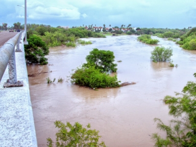
The International Boundary and Water Commission this week released a detailed study of problems on the Arroyo Colorado which they say currently can only drain at a rate of 45 percent of its design discharge capacity.
City officials say another rain event like the past June, where 16.75 inches of rain fell on Harlingen in a 96-hour period, may create serious flooding problems along a waterway clogged with silt and encroaching vegetation.
“When the conditions of the arroyo are impacting the adjoining communities, then we say its an IBWC issue, but that water is backing up into our cities and you’re saying it’s an internal issue,” Carlos Sanchez, an assistant city manager in Harlingen, told an IBWC meeting here last week. “Our cities require some sort of agreement or collaboration to maintain the arroyo at a certain condition so that the water surfaces of the arroyo do not rise with a 3-inch storm or even a 100-year storm.
“I think the arroyo is designed for a 500-year storm event, and that was not what we saw last year,” he added. “But again with what we saw it started impacting. My question is when you’re talking about a design capacity, how does IBWC seek to define capacity?”
Shallow, narrow
The 53-mile-long Arroyo Colorado is an important floodway which helps relieve flooding pressure along the Rio Grande.
It is a very shallow waterway, however, and that makes it an even more dynamic hydraulic system. In places vegetation throttles the banks of the arroyo, and silt drops to the bottom in slow-moving areas, and both complicate the waterway’s flow rates.
The top flow of the Arroyo Colorado at Harlingen during the rain event was 5,069 cfs on June 21, and the river’s flood gauge stood at 23.98 feet.
To get a sense of what that means, the flow rate on the arroyo during Hurricane Alex in 2010 was 5,500 cfs and the flood gauge reached 24.22 feet. There was significant flood damage around the Valley during the fallout from Alex’s landfall.
The Arroyo Colorado can only push water at 45 percent of the design discharge capacity of 21,000 cubic feet per second. But IBWC officials said at the meeting that after their improvements, the arroyo should be able to reach that 21,000 cfs flow rate.
“The way I’m reading the study that you all prepared, it’s having a cross-section where you can put down 21,000 cfs while not taking into account what happened to the adjoining properties or lands next to the arroyo,” Harlingen’s Sanchez said. “To me it’s a little bit too ‘centric’ or just focused on what’s happening inside the arroyo.”
IBWC’s plan
The initial hydraulic study parameters were six miles of the arroyo’s flow, from FM 509 to the Port of Harlingen.
But Apurba Borah, the agency’s lead hydraulic engineer, said the length of the study area was extended another three miles upstream to where South 77 Sunshine Strip/U.S. 77 crosses the arroyo inside Harlingen.
The IBWC’s plan would create a 50-foot vegetation-free buffer along the arroyo banks beginning at 77 Sunshine Strip/U.S. 77 and extending downstream nine miles to the Port of Harlingen.
The plan also calls for the removal of flood plain vegetation from 77 Sunshine Strip/U.S. 77 to the Union Pacific rail bridge No. 2 downstream.
The third leg of the stool would be dredging the channel to a depth of three feet from 77 Sunshine Strip/U.S. 77 to Cemetery Road Bridge near the Port of Harlingen.
The IBWC is responsible for maintaining the water way, and Harlingen city officials have said they expect funding for keeping the arroyo clear to come from the federal agency’s budget.
Source: The Monitor


