Posted on October 1, 2018
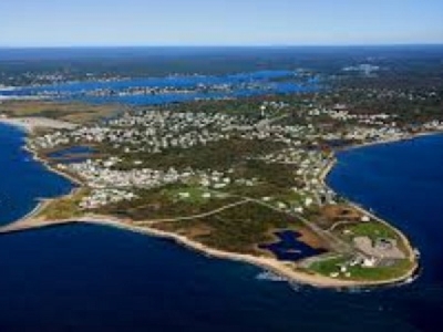
A major dredging project in Point Judith has been proposed by the New England District, U.S. Army Corps of Engineers (USACE) in partnership with the Rhode Island Coastal Resources Management Council (CRMC) that would significantly widen and extend an existing channel to allow smoother navigation of both commercial and recreational vessels entering and exiting the Port of Galilee.
According to an USACE press release, the proposed project would dredge approximately 23,700 cubic yards of sandy material from the Point Judith Harbor Federal Navigation Project (FNP) in an effort to widen the existing 15-foot deep Mean Lower Low Water West Bulkhead channel by 50 feet for a distance of approximately 700 feet and extend the same channel approximately 1,200 feet into the North Basin area at a width of 150 feet and a depth of 11 feet.
In the release, USACE pointed to the growing number of both commercial and recreational vessels making use of waters near Galilee in recent years that have caused navigational delays.
“The existing commercial and recreational vessels that use the Point Judith Harbor FNP have increased in number of the years,” the release reads. “New berthing areas over the pasts several years were constructed to meet increasing demand for use of the Port. The result has been that navigation delays and inefficiencies exist at the western and northern sides of the bulkhead.”
“The western side of the bulkhead is the primary work area and offloading area for fish haul and contains major fish buyers and fish processors,” the release continues. “The heavy use of this area by many of the vessels in the harbor and the narrow federal channel width result in frequent and significant congestion delays. Additional delays occur while vessels wait to offload catch. The waiting vessels make it difficult to for other vessels to pass safely in the channel to reach their berths, causing additional congestion delays.”
The dredged material, according to USACE, after it is dredged, the sandy material will be displaced in “nearshore waters” off of the Matunuck shoreline in South Kingstown, approximately three miles west of the harbor. The intent is to nourish the surrounding beach with the dredged material, which, according to USACE, has been chemically and physically tested to ensure its safety in being placed along the Matunuck shoreline.
“The dredged material will be placed in approximately 15 to 18 feet of water to allow the beneficial use of dredged material for beach nourishment,” the USACE release reads. “Construction will occur between Oct. 1 and January 31 of any given year in which funding becomes available and is expected to take two to three weeks to complete.”
The hope of the project is to accommodate “safe and efficient” vessel travel to the northern and western sides of the port, eliminating congestion and providing the commercial fishing fleet with “access to northern berthing areas built to accommodate increased demands for use of the facility.”
The CRMC is the local sponsor for the proposed work and is being coordinated with the U.S. Environment Protection Agency; U.S. Fish and Wildlife Service; National Marine Fisheries Service; Rhode Island Department of Environmental Management; State Historic Preservation Office; Rhode Island Department of Administration, Office of Strategic Planning; Rhode Island National Heritage Program and the Narragansett Tribe.
Source: ricentral


