Posted on June 18, 2019
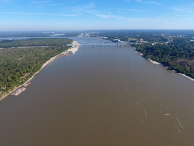
ROCHESTER, Minn. — Dave Francksen and Bill Chelmowski are getting a good look at the Mississippi River, from the bottom up.
The pair is running a survey boat for the U.S. Army Corps of Engineers as it works to clear dredge material out of the 9-foot navigation channel in Lower Pool 4 between the mouth of the Chippewa River and Lock and Dam 4.
“We want to get everything we need and nothing we don’t,” Francksen said.
Taking runs up and back along a short stretch of the river, the pair use a boat equipped with six sounding buoys that measure the depth to the river bottom. Francksen said right now they are conducting a post-dredge survey to ensure the navigation channel has been cut to the proper depth.
The survey, when compared to the pre-dredge survey, also determines the amount of dredge material that has been removed from the river, the Post-Bulletin reported.
The navigation channel — roughly 300 feet wide in straightaways and closer to 500 feet wide around corners — is an annual job of the Corps as it works to ensure safe passage for barge traffic that moves grain and other goods up and down the river, said Paul Machajewski, a dredged material manager for the Corps’ St. Paul District Office.
Right now, the river is about 8 feet higher than its LCP — low control pool — level. The extra height on the river means barge traffic could run up and down the river without the dredging, Machajewski said. But eventually, that extra water will flow downriver.
Despite the clear sailing in the Upper Mississippi River, Machajewski said closed locks and high water from central Iowa south toward St. Louis has kept barge traffic light so far this year. That said, the Corps wants to ensure the navigation channel is open once the river is ready for traffic from St. Paul to New Orleans.
“She’s high and she’s brought a lot of sediment this year,” Machajewski said.
Most years, the Corps pulls about 35,000 to 50,000 cubic yards of dredge material from the channel in the area near Reads Landing. This year, that total will be closer to 60,000 cubic yards. Each 1,000 cubic yards is about 100 dump trucks worth of sand, he added.
Machajewski said the main reason for the extra sediment is the late, heavy snow this winter and the plentiful rain that’s fallen this spring, bringing sand and silt down the Mississippi and from the nearby Chippewa River out of Wisconsin.
The extra sand and silt has caused the St. Paul District to bring in extra dredge crews. Currently, the district has five dredge boats operating, and two more are on the way. Dredging operations work around the clock to get the channel clear.
All that dredging work will keep survey crews like Francksen and Chelmowski busy.
Francksen said the survey uses the six transponders — two under the boat, two each on both the arms — to get a 25-foot-wide picture of the bottom of the river. The survey launch runs back and forth, “painting” the bottom of the river until a complete picture of the work can be drawn.
“We were surveying as soon as the river let us out there,” Chelmowski said, adding the late ice this spring kept them from surveying until later into May than usual.
After dredging near Reads Landing, where the Chippewa River deposited a large load of silt into the navigation channel, it’s on to a host of other sites — more than they typically see each spring — that need dredging done. “From here, we’ll move down to Crats Island, across from the Eagle Center in Wabasha,” Chelmowski said.
An AP Member Exchange shared by the Post-Bulletin.
Source: startribune.com


