Posted on May 27, 2019
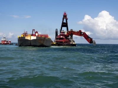
The ongoing deepening of the Charleston Harbor isn’t just letting bigger container ships into port: The work will also allow more salt water to creep up the Ashley and Cooper rivers.
The $558 million project to deepen the navigational channel to 52 feet will give South Carolina’s largest port the deepest shipping lines on the East Coast.
The work will further open the mouth of the harbor, which in turn will increase the “tidal prism,” or the amount of water that’s exchanged through the estuary due to tides. All together, about 324 acres of freshwater wetlands along the Cooper and Ashley Rivers will be impacted with higher levels of salt, according to an Army Corps of Engineers impact assessment.
The Cooper, which will see the most change in its wetlands, will see the outer edge of brackish water advance from the normal average by about a half-mile more than it would have without the project, by the time the work finishes in 2022.
However, the assessment also says that over time, the area’s freshwater tidal wetlands will be degraded more by climate change.
“Sea level rise represents the greatest source of change to wetlands within the impacted waterbodies,” the report said.
The areas most vulnerable to change as the salt advances are the freshwater and low-salt brackish zones, said Andrew Tweel, of the S.C. Department of Natural Resources. Generally, there is more plant diversity in the freshwater tidal wetlands, with fewer varieties of flora as the water grows more salty.
This means that in some cases, the increased salinity farther up the Cooper and Ashley could convert forested, swampy areas into salt or brackish marshes, with black needlerush and big cordgrass encroaching further upstream.
But that’s something that’s already happened over many centuries in the Lowcountry, said Tweel, who helped document the pre-deepening condition of wetlands along the two rivers.
“Swamps existed in much larger abundance than we have now along the Cooper River and Ashley River, and they were generally cleared for rice cultivation,” he said. “It’s hard to say (how much change is due to the deepening), because there were a lot of other impacts over the years.”
It’s also unclear whether the changes in water salinity will seriously affect local species like shrimp, which can sometimes move into open waters too early if the streams and marshes where they spend their early life cycle are not salty enough.
At the same time, increased salinity during times of drought can also have adverse impacts, leading the Army Corps to conclude that “the proposed project’s net indirect effects on white shrimp are likely neither adverse nor beneficial.”
Other impacts that affect the health of the harbor estuary system include increased stormwater runoff from development and high seasonal variability between wet and dry weather.
That variability is only likely to get more unpredictable, as carbon emission-driven climate change raises global air and water temperatures.
Research has shown that while climate change can lead to “rain bombs” — or particularly intense downpours — it will also increase the severity of droughts, another factor that lets salty water creep further up rivers and streams.
In 2002, when the entire state was in the most extreme drought category, some utilities started asking customers to cut back on water use, but main aquifers did not see salt intrusion.
Source: coastalnewstoday.com


