Posted on November 22, 2021
Reinforcing their sophisticated sand dune strategy to protect Key Biscayne’s shoreline, U.S. Army Corps of Engineers officials Wednesday presented their management study at a pair of virtual open house meetings to discuss the next 50-year protection plan.
Officials gave details on three important parts of the project for Key Biscayne’s tentatively selected process, including:
– The Corps’ plan to top off the newer, higher, reinforced dunes along the ocean perhaps every two years;
– Total damage reduction and recreational benefits of $9,974,000, as opposed to an unprotected shoreline;
– A timeline that could see construction begin as early as 2024-26, depending on Congress’ approval and appropriations.
Dr. Roland Samimy, the Village’s Chief Resiliency and Sustainability Officer, said a lot of engineering and science has gone into the study.

“We (Key Biscayne) have had a long relationship with the county, placing sand on our beaches for 46 years,” he said. “But as the current 50-year plan (which actually began in 1968 and work starting in 1974) is expiring (in 2025). We have to go back to Congress to continue this relationship to help transform the … international city we have today.”
Samimy and other officials pointed out other significant benefits are derived from shoreline protection, including those economically — preserving property and tourism — and environmentally –no impact on seagrass resources.
The Miami-Dade County Coastal Storm Rísk study originally only included the area from Baker’s Haulover Inlet at Bal Harbour — an artificial inlet cut in 1925, where erosion has been the greatest — all the way to Government Cut in South Miami Beach.
But, Key Biscayne — with its coastal vulnerability not only to storms but also impending rising sea level — was added to the federally funded environmental assessment last November, increasing a three-year $2 million study to four years and $3 million.
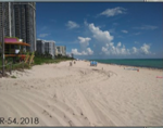
Marty Durkin, lead planner on the committee, showed what Key Biscayne’s beaches looked like in the ‘70s, with a seawall and minimal beach in front of it.

“But now it’s important to protect everything from infrastructure, environment, recreation to tourism,” he said.
The process is currently in a 30-day window for community engagement, with residents being asked to submit comments or concerns by Dec. 12 to the Army Corps at kristen.l.donofrio@usace.army.mil or email VKBShorelineProtection@keybiscayne.fl.gov directly to the Village.
From there, the agency will issue a “selection” decision milestone in February, 2022, before the state and agency review final report comes out in August. Then, the final report from the Chief of Engineers is due in October, and engineering phases may begin no earlier than 2024.

Studies were conducted looking at the need over the next 50 years, using time-lapse technology with the highest-level sea rise as the model. Studies also compared structural and nature-based features if alternative measures were used, such as simply replenishing sand every few years.
Now, with a plan calling for a reinforced dune wall with a concrete cap and tie-back walls along the northern and southern boundaries, Key Biscayne appears headed into the meat of the $267.6 million project that includes construction and maintenance.
Key Biscayne’s low-lying elevation was a key in being selected to this point. Durkin said the Corps will be using the same footprint as they have done up the coast, where some dunes rise as high as 13 feet. On Key Biscayne, Samimy said dune crests could reach as high as 12 feet in some areas, maybe five feet in others.
The “Main Segment” of the plan, from Bal Harbour to Miami Beach, would mean $40,552,000 in total benefits, including a whopping $36,817,000 in recreation benefits.
There’s no word if President Biden’s Infrastructure Bill, which passed this week, would absorb any of those expenditures.


