
Posted on August 4, 2016
By Lisa Maher, Fairplay
Much is talked about the possible uses of drones or – to give them their proper titles – unmanned aerial vehicles (UAVs) or unmanned aircraft systems (UASs). How useful could they be for those in the dredging and port construction sectors?
During the last quarter of the 20th century, ever-improving technology allowed greater miniaturisation of both drones and the computer chips within them, so interest in and refinement of the necessary science grew apace.
On land, they can be used for reconnaissance (military or otherwise), policing, data collection, site security, and more. However, their use in a maritime context is more proscribed.
UAVs can be controlled one of two ways – by a human operator who can see the area being overflown, or pre-programmed by a computer.
If controlled by a human operator, that person must be specifically trained to operate a particular model and must have an appropriate licence from one of the relevant authorities. That will vary depending on where the maritime project is to take place.
Drones are reusable and categorised by weight (loaded) carrying a payload – which could be a camera or a parcel. While similar to remote-controlled missiles, those are not reusable.
Their flight limits – height and range – are determined by weight and the amount and/or type of fuel. So they can survey a patch of coastline but, with flying times generally between 20 and 90 minutes, they are unlikely to be used in travelling to an offshore site or reclamation area unless within a short distance of the operator/original launch site.
The costly units are vulnerable to visibility, operator error, collisions, weather, fuelling limits, and other factors such as changing wind patterns around buildings.
So while they can swoop down to as little as 10 m from the ground – clearly reading number plates, for example, or checking a cliff face or railway bridge supports – a number of factors can complicate their usage. Anything that creates turbulence can damage or otherwise knock them off course; so they cannot be used near transport, or anything with heat or waste gases. Generally, the vehicle needs to be kept 50-150 m away from built-up or inhabited areas and anything likely to affect its stability or surrounding airspace.
In particular, the vehicle needs to stay clear of members of the general public for safety and privacy – whichever data privacy act applies in the country where you are carrying out the drone survey may have its own definition of infringement.
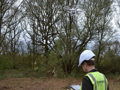
As mentioned, Smith is one of the UK’s few trained UAV operators and Thomson Ecology has been investigating the use of drones for the past nine months; projects it has been asked to consider undertaking include wildlife impact adjacent to a work site, building inspections, and coastal stability surveying.
He explained, “Ideally the area being overflown needs to be empty, whether that is a field, the sea, or a stretch of coastline.”
For a working port, Smith suggested, “People, machinery, cranes, containers, vehicles…it would be pretty impossible.”
In addition, the lines become more blurred when scanning over private property – a business would need to take legal advice on whether it would be infringing employees/visitors’ privacy, or if the act of entering a signposted area – such as a port, quay, terminal, and so on – could be deemed consent.
On the plus side, UAVs can go where humans sometimes cannot; so “they can save time in the field and reduce personnel exposure to risk”, said Smith.
There is currently no single ‘operate anywhere on any type of UAV’ licence available and there is never likely to be one. Every make of UAV is fractionally different in some way; the operating principles may be the same as another but, to be proprietary, there must also be differences. Just as every ECDIS system is different – and most maritime personnel know the difficulties that has thrown up – so is each UAS.
If a company were to invest in a drone – which can cost from GBP1,000-150,000 (USD1,200-180,000) depending on complexity, payload camera quality, etc – it would also need to train more than one employee capable of controlling it, and provide support staff to interpret the data. That is a significant monetary commitment demanding ongoing use over more than one project.
A less-expensive option is to invest in a remotely controlled drone following preset parameters; with fewer variables, the data quality is likely to be reduced but it can carry out pre-determined repeatable overflying.
A further option – depending on where a project is based – is to hire in drone services on a specific project basis, or by sharing costs between all interested parties. This could work well on, for example, a pre-project aerial survey of an environmentally sensitive site where numerous authorities and potential contractors could all contribute to the cost or offset the costs by paying an access-to-results fee. Smith noted that he knew of at least one project for which this solution was being explored. “It would make sense to have one survey done, with minimal disturbance to wildlife and the terrain, with all parties able to access it.”
In summary, it can and will become another useful tool in the marine engineer’s toolkit; but – while less costly than employing a team of surveyors or engineers – it will probably never be cheap and there will always be restrictions on when and where it can be used.
Source: Fairplay


